
Part II - Horsham to Mildura
Last updated 2022-03-24 | Word count: 7,000 | Reading time: ~ 40 minutes
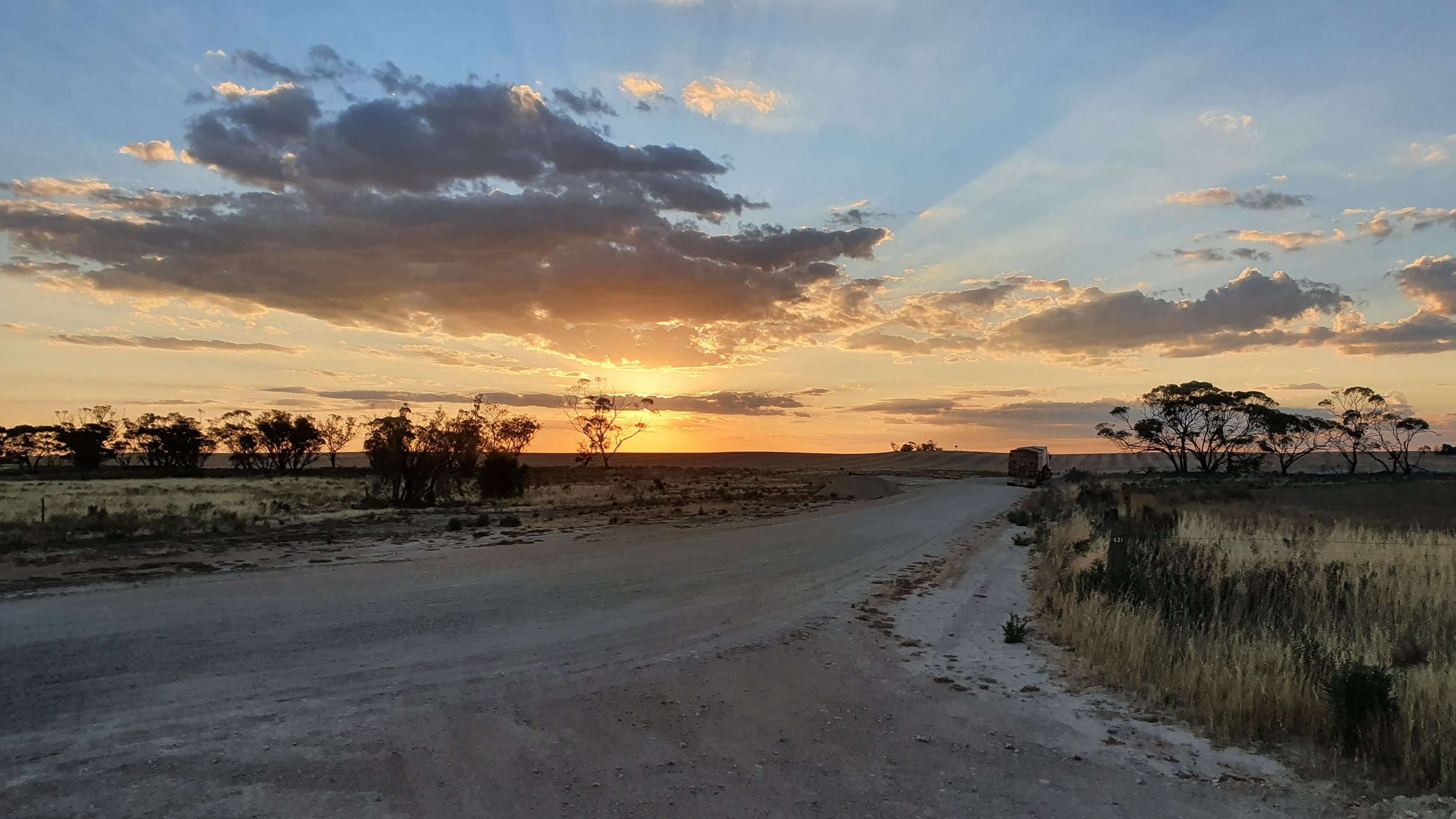
Wednesday 19th January 2022. 2030hrs looking west over Nypo Gypsum Mine as the sun sets whilst I ride to Wyperfeld National Park. I am less than 10km from the entrance on Wyperfierld Park Road.
Today (Day 04 - Strava link) has been a tough day. Not that long ago, I wouldn't have made it this far. I wouldn't have left Rainbow. I am hot, tired and I've had enough of the wind. On Strava, I am particularly brief:
"A really fucking hard day where I wanted to give to at Rainbow but pushed on for another two and a half hours.
The wind. The flies. The sun."
Tomorrow I'll wake up to find the warning sign about the feral bees is true. I'll begin to reframe the wind and turn up with a better mental attitude. This is good timing as the wind will be a constant companion in my face for the coming week.
Someone from the WhatsApp group tells me how they once rode into the wind for 50km. A week later, I will say I think I'm at 500km. They don't reply.
Once I found there were desert national parks on the western border of Victoria, my interest became plotting a route to ride the most western roads possible without being in sand dunes. This route is almost completely accessible by road bike, and a stunning tour of very accessible desert national parks. Possibly one of the few, if only ways to see this landscape in Australia on a sealed road with towns reasonably close.
Leaving Horsham you quickly realise how the landscape changes as you head northwest. The dry plains become sand. The gravel roads off to the side become 4WD only. The sunsets begin to change and become something special as tropical hues become wash away in the darkness. There's a stillness and quietness that you can feel as you travel through this region. The heat begins to build, the warm afternoons very quickly become hot and dry.
Information online is limited about conditions in the desert national parks. After a few emails, I came to the conclusion that crossing Wyperfeld, Big Desert or Murray Sunset National Parks would be too difficult on the bike I had (gravel bike with 37mm tyres). These seem to be the purview of fat bikes, or at least plus bikes. This decision constrained me to ride the westernmost route from south to north. I decided to pass through Horsham, Nhill, Jeparit, Rainbow, Yaapeet, Patchewollock and Ouyen. Time permitting you could head to Linga and visit the Pink Lakes as I initially planned.
Day 03 Halls Gap to Nhill | Day 04 Nhill to Wyperfeld National Park | Day 05 Wyperfeld National Park to Ouyen | Day 06 Ouyen to Mildura
Doing this ride yourself
Route: Horsham to Mildura | Distance: 550km | Elevation: 1,700m
Moving time: 26:18:03 | Elapsed time: 40:28:22 | Ride with GPS route
Note: This ride starts at Horsham, but you could start from Ararat as there is a V/Line train from Melbourne. This would add an additional 100km.
You could do this route in 2-6 days. Three is doable, four would be a bit more enjoyable. In the four-day version, you could stay in Jeparit, Yaapeet (having visited Wyperfeld) and Patchewollock.
This route is almost completely accessible by road bike, and a stunning tour of very accessible desert national parks. Possibly one of the few, if only ways to see this landscape in Australia on a sealed road with towns reasonably close. The only section that is busy is the Calder Highway from Ouyen to Hattah. Some of this can be avoided by the Old Calder Highway.
Getting there: You can get to Horsham from both Melbourne and Adelaide. via The Overland. Trains from Melbourne depart Monday & Friday, and trains from Adelaide depart Sunday & Thursday (timetable). Travel time from Melbourne is 04:45 and travel from Adelaide is 05:15hrs. Both services leave in the early morning.
You can get to Horsham from Melbourne by taking the V/Line to Ararat and then transferring to a coach.
Getting home: Mildura has a domestic airport with daily flights to Sydney and Melbourne as well as flights so Adelaide and Broken Hill.
You can catch a coach to Swan Hill and from there catch a V/Line train to Melbourne. There is also a direct coach service.

Daily: 147.90km | 7:24:28 | 575m
Total: 471.89km | 21:51:45 | 2,450m
Day 03 Halls Gap to Nhill
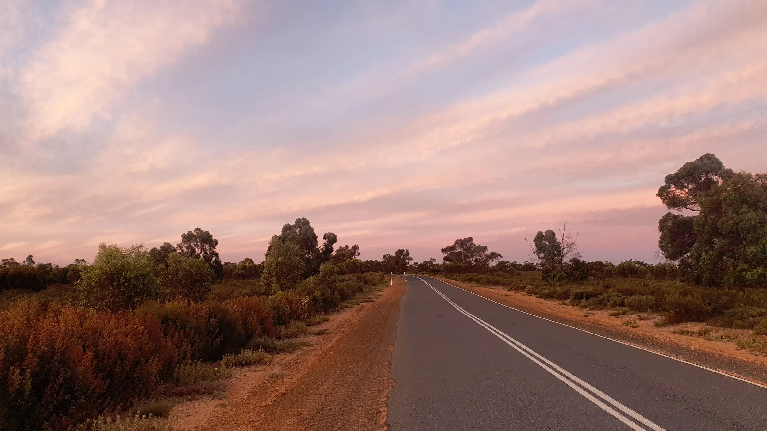
Tuesday 18th January 2022. 2100hrs riding north across the Little Desert National Park as the sun sets and the sky brightens with hues of tropical colours, only to have these slowly wash away as the darkness encroaches (Day 03 - Strava link).
This was the first of a few memorable sunsets I was to experience in western Victoria, part of the state I'd never thought about visiting, and now I want to go back. The experience is the metaphor. Few of us know what we want, how could we if we don't know what is available? Part of why I write these (very) long reports is to share these experiences, as it seems no one else does. Very few people may come out here and ride, I didn't see anyone on a bike the entire time I was out here.
Most reasonable people would, having arrived late in the afternoon with errands to do, stayed in Horsham that evening. I headed west, aiming to make it across Little Desert National Park with the plan to camp in Nhill, not entirely sure if the road was sealed or not. This sentence captures the general lack of planning I did for the trip. Writing this report from the luxury of being back at home many months later I can easily see via Google Street view that the road is sealed. Late in the afternoon I am tired and, having to work through so many navigation decisions, this was much harder than I make it seem.

Tuesday 18th January 2022. 1730hrs riding west towards Natimuk on the Wimmera Highway. Over the coming week I'll begin to see disused bus stops from two different perspectives. The first and most obvious is as a place of shelter. You're protected from the sun (or rain) on three sides and there is somewhere to sit down. A table would make this the perfect trifecta. Tables are underappreciated. A second perspective is to wonder why this is here; where did the buses go and whom did they transport? This is one of the few (if only) bus stops with a bike rack. We now have to park and ride (the train) as a common form of transport. This shows a time when you'd cycle and ride (a bus).
At Mitre I stopped in to find water and struggled to find anyone in any of the handful of houses grouped together. Seeing a few houses next to each other surrounded by paddocks makes suburbia seem odd. Eventually I found someone that let me fill up all my bottles. I think I left with over 5L as the sun started to dip in the sky. This was my first 'desert crossing' and I was concerned about running out of water. I was assured by the person I met in Mitre that the road conditions were good and that I'd be fine.
The next two hours presented the first special sunset of the trip. Watching the sky brighten with hues of tropical colours, only to have these slowly wash away as the darkness encroaches is an experience the photos cannot do justice to.

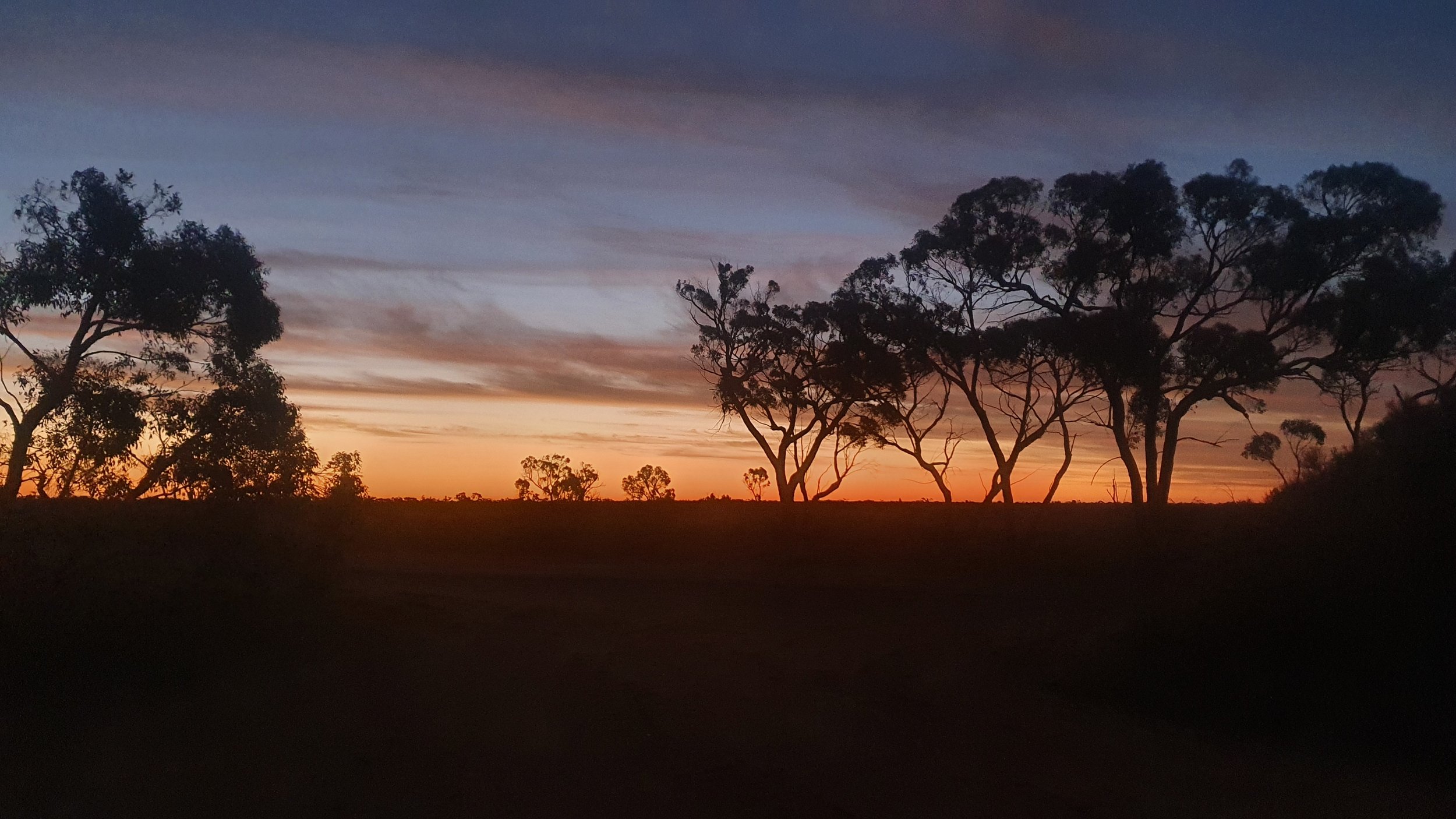
Tuesday 18th January 2022. 2055hrs looking north and west (L-R) on Nhill-Harrow Road (Street View) in the middle of Little Desert National Park. It's hard to imagine so much light, so late in the day, on a quiet sealed road through a desert. I'll only see a handful of cars whilst riding this stretch of road.
2130hrs looking west on Nhill-Harrow Road as the last of daylight fades into evening. I'm on the northern edge of the national park. There's a cool breeze and I am keen to find somewhere out of the wind. In 15 minutes I'll be inside someone's shed setting up camp for the evening.
As night fell, I saw a light in the first house on the northern side of the desert and decided to pull in and ask if I could camp in their yard. The elderly woman that came out eating an ice cream was a little surprised, but amenable to my request and let me sleep in their shed. This tuned out to be a good decision as I could charge my phone and other devices overnight. I worked out I needed to find someone every two to three nights with the limited capacity in my power banks. I quickly realised that if I wanted to stay on someone's property I needed to get there before it was too late to ask permission (which was always granted). The long hours of daylight let me arrive later than I was used to.

Daily: 160.16km | 7:34:18 | 606m
Total: 632.05km | 29:26:03 | 3,056m
Day 04 Nhill to Wyperfeld National Park
Wednesday 19th January 2022. 2000hrs heading north on Yaapeet Road having missed the turnoff to Wyperfeld Park Road (Day 04 - Strava link). I'd been told by a truck driver at Rainbow that the road is sealed all the way to the entrance of the park, after a few kilometres of riding on gravel I checked the map and found that I was heading in the right direction on the wrong road.
Had I made the easy and obvious decision to stop in Rainbow when I was physically tired and mentally defeated I wouldn't have seen this sunset. The metaphor is we take away experiences that are more special than we can imagine because we can't overcome the discomfort in the moment. The more nuanced version is not to say the sunset is better than staying in Rainbow in air-conditioned comfort, but to see these are parallel alternative experiences. Our collective failure is first not to see this and secondly not to select from multiple parallels. The person that only suffers through hardship is as narrow in their conception as the person who only experiences comfort.
I can't remember the last time I slept in a shed. This was a classic country shed, designed for working on farm equipment. Little is thrown out as one doesn’t know when one might need it. Last night was the first time I realised that sheds are the ideal shelter. They have power to charge my devices but they are separated from the main house. After chatting with the guys that came by in the morning, I finally left (later than I thought possible) and rode the short distance into Nhill where I visited the local IGA to pick up food for lunch.
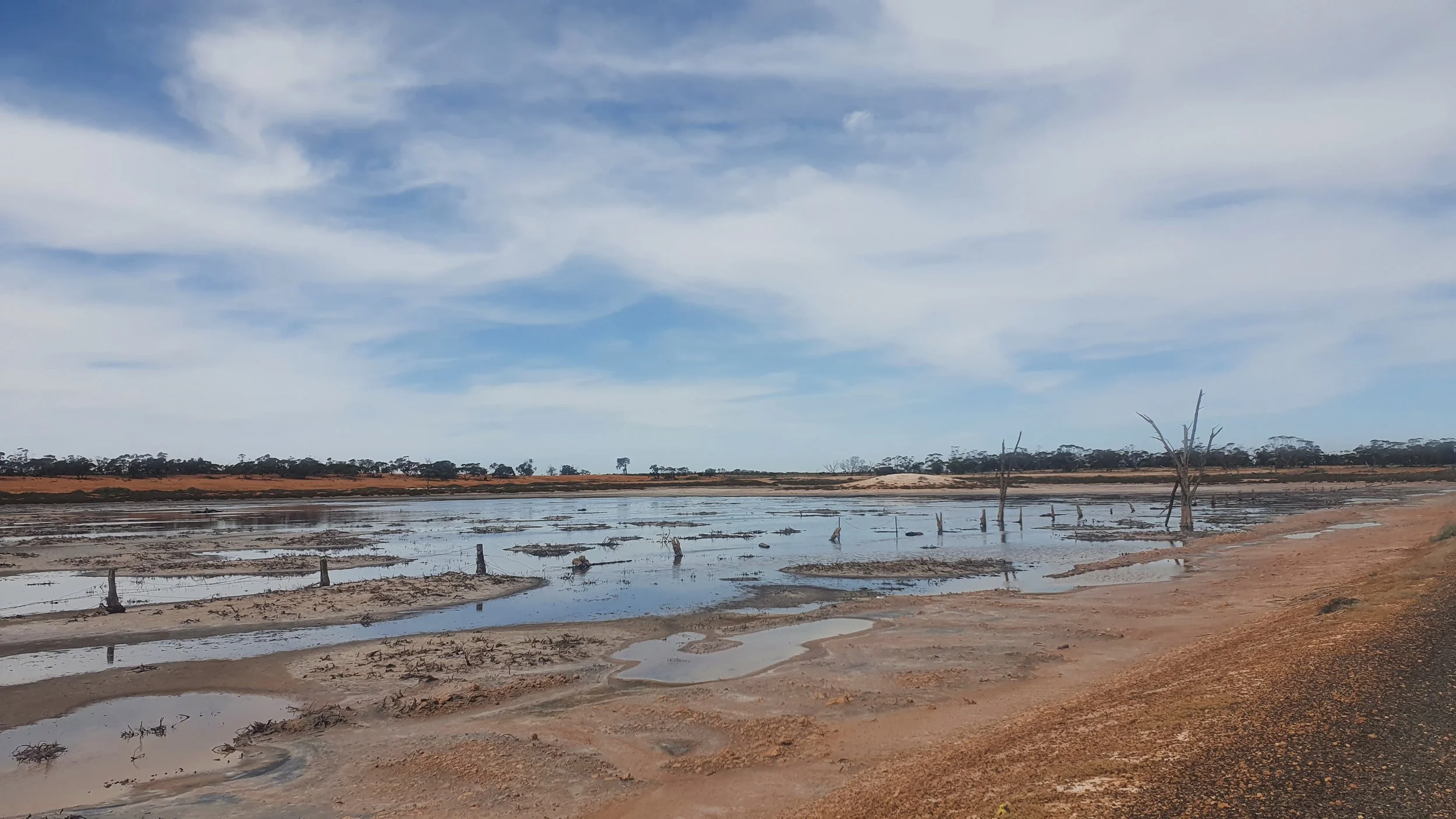
My plans for following my GPS route had long since evaporated. I had a paper brochure I was using to plot my route. The goal was to make it to Wyperfeld National Park, and I planned to take the most direct route, heading to the east of Lake Hindmarsh via Jeparit. Upon approach, I decided to skip the town as I had sufficient food and stay on the western side of Lake Hindmarsh. Although the lake couldn’t seen from the turnoff, I thought this might be worth looking at. As the lake came into sight, I was surprised not see any water; instead before me was a barren sandy expanse radiating heat from the sun directly overhead. There was a clean, modern, enclosed picnic area near the lake (with a fridge and bbq). Lunch was some warm roast beef, a very soft wheel of Camembert, carrot, zucchini and crackers. Being in the shade, off the ground and out of the wind is a luxury. Lake Hindmarsh was my first experience of a blue section on Google Maps where there was no water. The first of many.


Wednesday 19th January 2022. 1330hrs Four Mile Beach at Lake Hindmarsh. The sign at the entrance states a maximum depth of 6m and a capacity of 430,000ML. The lake has been dry for a number of years. In December 2022, Lake Hindmarsh had water again.
The facilities have been substantially upgraded since Street View from 2010. You can see the old facilities in the foreground from the new facilities. Being in the shade, off the ground and out of the wind is a luxury. Lake Hindmarsh was my first experience of a blue section on Google Maps where there was no water. The first of many.
Lake Hindmarsh was the first point in the trip when I had a sense of just how hot, dry and arid this section of Victoria could be. The previous evening in the desert was cool and pleasant. In the early afternoon the sun was baking the dry landscape. Looking over the lake, it was hard to image a time when this might be full of water and the boat speed limits would be relevant. Leaving Lake Hindmarsh I headed for Rainbow, the next town. Little did I realise that I was about to experience what was probably the hardest moment of the trip.
I'd been riding into the wind for a few hours already (from memory NE ~ 20km/hr+ gusting well over 30km/hr). I remember pulling over to the side of the road and looking at the forecast for the towns on my route over the next week. I realised I would be riding into a headwind all week. Today was just the start. I was tired after just a few hours. This broke me mentally and I thought about trying to get to the next town and wait out the wind, which of course, is futile.


Wednesday 19th January 2022. 1530hrs Rainbow-Nhill Road at the northern end of Lake Hindmarsh. There are many large trees, but few are near the road. It's around this time I am feeling emotionally defeated by the wind. rainbow is less than 20km away but this short section of the ride will take me an hour and a half to complete. I still don't know how.
1645hrs Rainbow-Nhill Road just outside of town is the Rainbow Airport. For a population of fewer than 700 people, the dirt airstrip looks quite nice. The wind sock confirms what I already know, I'm riding directly into the wind.
I arrived at Rainbow feeling pretty defeated with life. Frozen fruit and yoghurt from the local IGA gave me a slight pickup, but I seriously considered calling the day at this point. I arrived at 1700hrs, which seems a reasonable day of riding (even if you start late). I was once again unsure of road conditions north, the person at the service station seemed to have never been north (what do these people do?) but a local truck driver overhead me. He assured me the road was good but to stay off for the next hour whilst the last of the gypsum was being hauled for the day. I took his advice, sat in the shade and headed off around 1800hrs. He waved to me as we passed each other as I was leaving Rainbow.
Getting on the bike and heading north was a defining moment in the trip. I'd experienced hardship, I hadn't been broken. Instead of giving up, I continued. This is the narrative of the 'hero's journey' a classic and often used story technique. The experience is far from enjoyable. It's only with time to reflect one can see the outcome. I often wonder how many of these moments I've missed in my life.
The early evening and I continued north, taking a detour to see the Silo Art that was signposted. I was unaware this was out here, but felt that it was worth having a look given the unlikely nature of being out here again any time soon. This idea, that I'll probably never be at this point again, became something I looked back on after the trip as a defining way to see the world as a positive experience.


Wednesday 19th January 2022. 1815hrs (clockwise from top left) Albacutya Road crossing over Yaapeet Railway looking at Jacks Track.
At the viewing point which almost every drive to, but I've ridden. I think one other person turned up whilst I was there, had a quick look and drove off.
Just before the turnoff to the silo art, there's a mobile sign informing people of a speed camera. I wonder why this is here. What set of circumstances caused a speed camera to be set up on a dirt road west of Yaapeet? There is a gypsum mine and the entrance to Lake Albacutya.
Further up Albacutya Road with the silo art in the distance it’s hard to appreciate the detail and size even upon approach. You can see the speed camera sign in the distance.
Profound is overused. For all the time and opportunity I have ahead of me, many activities I will never undertake again. Seeing hardship as part of the process to experience a moment, I came to understand not to avoid nor embrace hardship but to accept hardship. Whilst I was hot, tired and had enough of the wind, standing in the carpark looking at the silo art in these conditions gave me a greater sense of what life is like out here. Had I stayed at Rainbow and arrived early and refreshed from a good night of sleep, looking at the silo art would have had a hollowness similar to looking at photos on social media.
The use of a silo as a canvas is impressive. Seeing the sun break through the afternoon clouds added to the moment. Only hours earlier I wanted to give up, find an airconditioned room and stay at Rainbow. Here I am alone, taking in an artistic endeavour. I struggled to find public water at Yaapeet and should have just stopped in at someone's house. What I did find, I am not sure was drinkable.
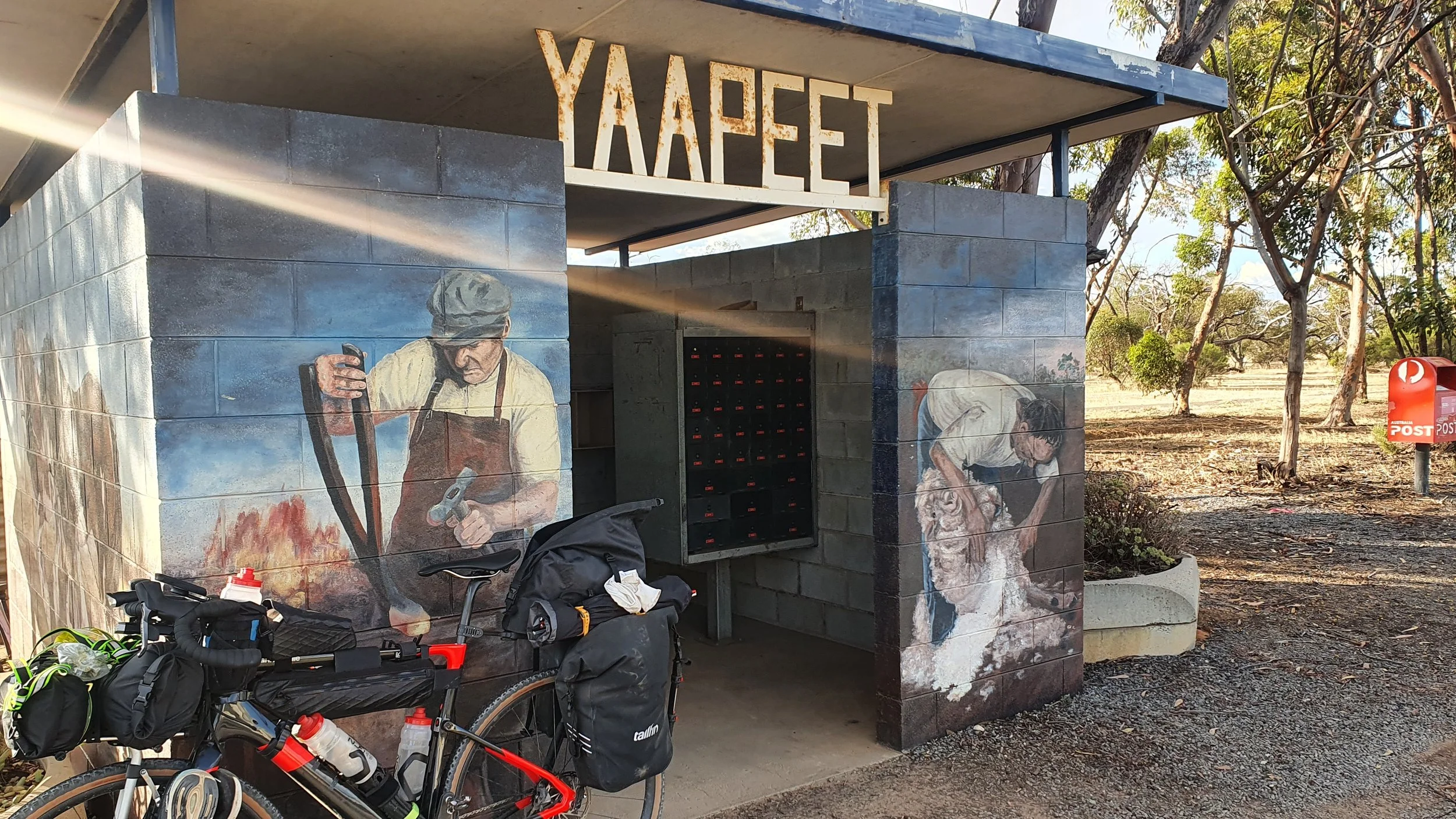
Wednesday 19th January 2022. 1900hrs Bryne Street in Yaapeet (Street View). Based on the small size of the town, it seems like a lot of people have post office boxes.
I made my first navigational error for the day and ended up heading north on the wrong road, which happened to be gravel and a bit rough. I could have continued north and probably made it into the park, possibly dealing with some sand along the way. I erred on the side of caution and turned around to find the main road. With darkness encroaching and Wyperfeld so close after a tough day, I didn't have it in me to continue on an unknown road. I'd like to think that, had I been there earlier in the day I would have continued. Maybe I needed to see that my limits were entirely self-imposed to appreciate this later in the trip and do what feels unnatural.

Wednesday 19th January 2022. 2010hrs riding south on Yaapeet North Road having just missed the left turn to Wyperfeld National Park. I've already ridden a few kilometres up the road and seen a full-sized fridge painted in St Kilda team colours (I assume as an oversized letterbox). This is the last hill before I rejoin the sealed road. I remember the moment being more stressful than the serenity of the scene would suggest.
I finally found a campsite in Wyperfeld close to 2200hrs as the last of the light faded. I noted the signs informing of me of the feral bees but thought little of the issue as I was already contending with ants all through the bathroom. I settled into my first bush camp for the trip, unaware that the heat, wind and flies were only going to build from here.

Daily: 153.43km | 7:47:17 | 721m
Total: 785.48km | 37:13:20 | 3,777m
Day 05 Wyperfeld National Park to Ouyen
Thursday 20th January 2022. 1035hrs on James Barrett Nature Drive in Wyperfeld National Park (Day 05 - Strava link). 10 minutes earlier I had a chat with someone heading down the Dattuck Track. This is the only person I'll see for hours. A quick look suggested Dattuck Track is sandy and soft, not suitable for 37mm tyres unless you're up for a lot of pushing.
There's a sealed road all the way into Wyperfled National Park, and a guidebook available written by Geoff Durham and Leon Costermans which is no longer in print but is available online.
Wyperfled National Park is Victoria’s third-largest national park, famous for its birds, including the remarkable mound-building malleefowl, and also has many mammals and reptiles and a wide variety of wildflowers. Wyperfeld is in the country of the Wotjobaluk people, and the park has many scarred trees and recordings of middens, artefacts and burials. European settlers avoided the area because of its infertile sandy soils and low rainfall, so the land was not cleared and the native plants and animals survived. The park was first reserved in 1909 and has been greatly enlarged since to its present area of 357,017ha. Source: Victorian National Parks Association.
I woke up the following morning when the sun rose (my standard approach) to find an empty campsite and National Park. I washed my jersey and hung this up whilst I made coffee, ate breakfast and packed up. Within an hour of being up, I noticed that the signs were right; the feral bees like water. I found a swarm of bees on my branch-hung jersey. The benefit of the bees was that I knew when the jersey was dry as the bees left and found another source of water.


Thursday 20th January 2022. 0645hrs just off Black Flat Track watching the sun rise over Lake Brimin. There are multiple signs on the toilet block regarding the bees. One of them states:
1. Make sure all water containers are sealed. 2. Try to reduce the amount of water used within your camp. 3. Bees are active from sunrise to sunset so avoid water usage during this period.
Seems unreasonable to expect people to avoid water usage during the hours they're going to be awake.
0915hrs as I am about to leave the campsite and head off to ride around the park. The bees did not seem very interested in the water I boiled for my coffee.
Day 05 was the first day I started wearing a long-sleeve, loose-fitting shirt, which was far more comfortable than a jersey and arm sleeves for a variety of reasons. I doubt I'd ever wear a jersey on a long adventure ride again. The three biggest drawbacks of the jersey and arm sleeves are:
They are unnecessarily tight (I'm averaging 20km/hr on a bike weighing 40kg, I don't need aero)
The zip, whilst a nice idea, just rubs on you and annoys you
As the trip went on and I felt (was) bloated at various points this was pronounced with a tight jersey as opposed to a loose-fitting top
I struggled to find any benefit to wearing a jersey with the exception of the rear pockets, which I rarely use as this feels about the same to me as wearing a backpack. If I want to access something easily, I want it in a bag on my bike. If I don't need to access it easily, I'd rather pack it away.
Before heading off I rode the loop inside Wyperfeld National Park (James Barrett Nature Drive). The road conditions were amazing for a non-sealed road and you could easily ride a road bike around here. I met one person who was heading through the park on Dattuck Track. I had a quick look at the track and whilst some of the soft sand looked ridable, I kept to my plan and headed back out the way I came. I was briefly tempted to try and head out via Lowan Track which links up with Websters Road.


Thursday 20th January 2022. 1030hrs (main photo) on James Barrett Nature Drive at the easternmost point of the loop. With a more suitable bike, you could take the Dattuck Track east until it turns into Wirribibal Track and follow this around to Dattuck Road which would take you out to Hopetoun-Walpeup Road. Good luck finding any information online about this route.
The conditions inside Wyperfeld were perfect, with a light breeze and a warm morning. Upon leaving the park, the wind returned; the morning and the rest of the day were going to be hard. I was pedalling into a 30km/hr easterly wind, on a heading due east. I noted on Strava:
"Harder conditions than yesterday with more hours directly into the 30km/hr+ easterly, but a much better mental attitude. It's been hard to reframe the current situation into something positive, but I am trying."
The 67km into Hopetoun had a moving time of 03:41 for an average of 18.1km/hr. At the supermarket I made a poor choice for lunch and purchased rice cakes. I struggled to find anywhere out of the wind, which meant I spent a lot of mental energy trying to keep my food and packaging on the table. The rice cakes where quickly being blown away as I tried to make them into something edible. The second and more important issue was that they were so dry they were difficult to eat. I decided that I didn't want to take this problem with me. I abhor wasting food, so I stayed in Hopetoun until I finished the entire packet of rice cakes and mentally reminded myself not to buy these again. Leaving Hopetoun, I'd started to become aware my rear tyre and the tread were rapidly disappearing. I'd also realised I could probably make Mildura by Friday afternoon/evening, which was exciting and felt like the first part of the trip would be complete.
At Patchewollock I stopped in at the pub to fill up my water bottles and one of the locals quipped 'you might need to check your GPS' when they asked where I'd come from. Australia rightly considers itself the home of 'big things'. The ’Big Mallee Fowl’ is not one of the big things you need to see. The handful of paragraphs detailing the history of Patchewollock railway is worth reading to imagine how the country used to be. "Families along the line would stop the train in the middle of nowhere by waving a lantern to receive their provisions." The weekly goods train only ran for 50 years between 1925 and 1975. It's hard to imagine less than a century later the progress of civilisation, and what it must have been like to know you had once chance to get provisions for the week. I am reminded of how much information can be conveyed in a few paragraphs, and wonder if my trips reports could be shortened.


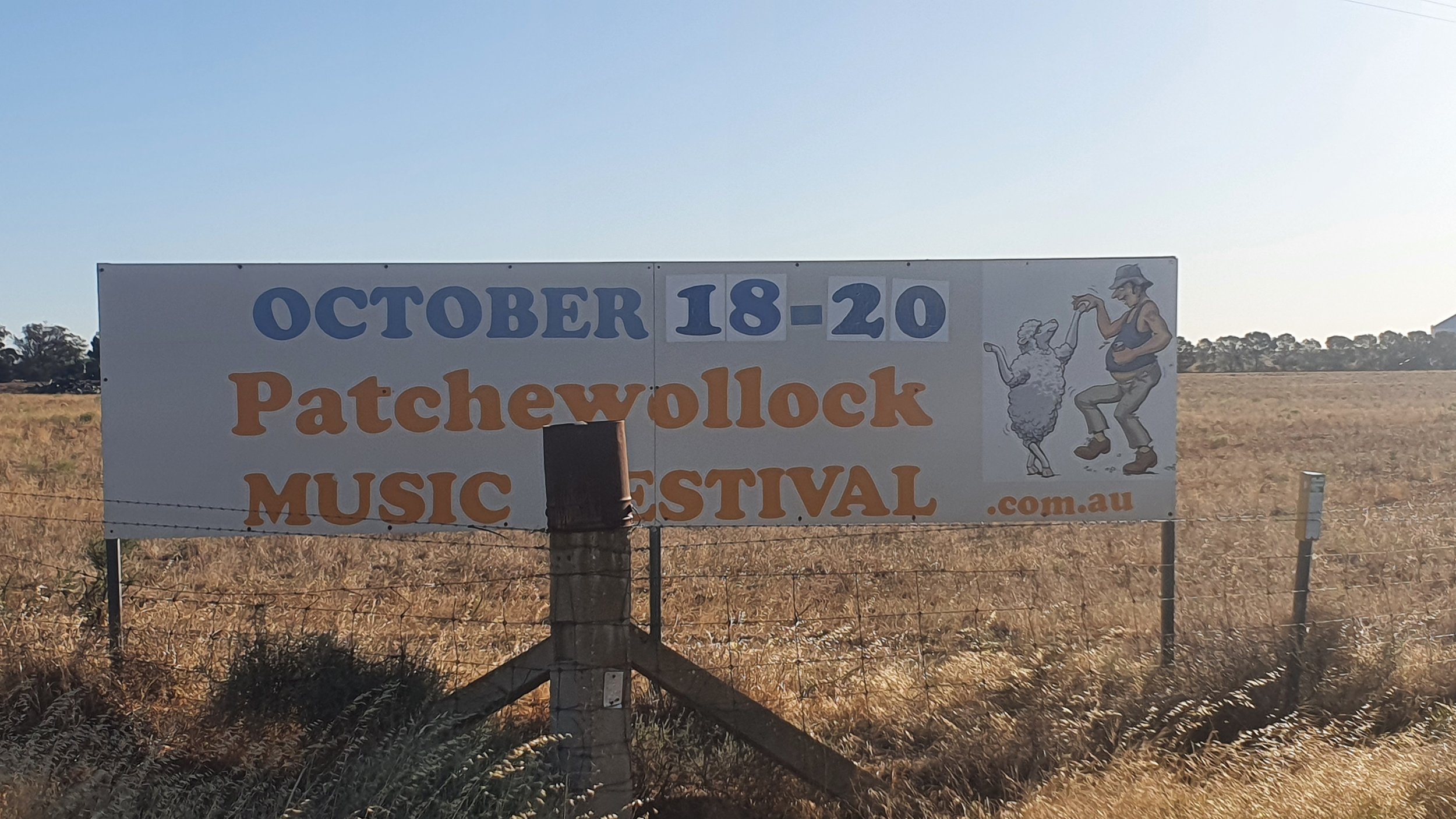
Thursday 20th January 2022. 1915hrs Federation Street, Patchewollock. I've detoured off the main road to find water in Patchewollock. For a change I went to the local pub, the bonus being the water was cold, and the conversation that uniquely Australian sarcasm that you laugh along with because it's funny. With the long daylight hours, I hadn't realised how late I was at the pub and I was surprised by so many people in what felt like the afternoon but was evening.
The contrast between the two signs couldn't be more apparent. The original is an odd choice of materials and seems to have been constructed from what was easily available. The modern sign is detailed and describes the malleefowl as "... a true marvel of the Australian semi-arid landscapes." Malleefowl use external heat sources to hatch their eggs.
I planned to try and make Ouyen for the evening, but eventually gave up and looked for a camp site. On Google Maps I saw a bushland reserve and thought this would be a suitable camping spot. As I rode in, I realised I'd made a poor decision but felt stuck with my choice. There was no area that seemed to be clear of scrub, and nowhere you’d describe as ‘flat’. I picked what seemed like the best corner. After setting up camp and crawling into the tent I realised I’d set up camp on bindies and felt them under my sleeping pad. Instead of moving the tent and fixing the problem I put clothes down and went to sleep to wake up on a deflated mat. My attempts to repair this in Mildura proved futile and I got used to inflating the mat multiple times each night. The following morning the owner of the property drove and out and said I should have stayed with him. Had I ridden an extra 100m up his driveway I would have seen a light on in his house.

Daily: 146.31km | 7:06:16 | 668m
Total: 931.79km | 44:19:36 | 4,445m
Day 06 Ouyen to Mildura
Friday 21st January 2022. 1930hrs Red Cliffs Lookout (Street View). I'm an hour away from Mildura and will make it into town as the sunlight fades. Today is the last day I'll be in Victoria (Day 06 - Strava link). It's been a hot dry afternoon riding next to Australia's longest and most iconic river 33C at the time of the photo.
On Strava I noted "10km from the Murray, you'd have never known there was a massive river system so close by. It's still desert so close to the river."
I had initially planned to visit the Pink Lakes of Murray-Sunset National Park with the hope that I might be able to ride through. Early in the trip I discounted riding through but thought I might still visit from the southern side. Looking at Google Maps I worked out this would add roughly 150km onto my trip (75km each way) for the out-and-back which would be at least another day. Pink Lakes to Mildura is 180km, which is further than I had been riding in a day. Either I wouldn't be able to camp there and make Mildura in a day, or I'd just have to ride longer and harder than on any previous day. Finally there was the issue of my rapidly wearing out rear tyre. I passed on the idea.


Friday 21st January 2022. 0630hrs Weir Road off Ouyen-Patchewollock Road. I described my camp spot on day 05 as "I realised I'd made a poor decision but felt stuck with my choice." I would live with the consequences for the rest of the trip as despite my efforts to repair my mat in Mildura these failed.
As I am finishing packing up at 0930hrs the owner of the property drove past and we chatted about life on the land. He said I should have come up and could have stayed in his shed. His dog had a beautiful temperament and was not a dog I'd associate with farming. Apparently, the dog has incredible energy and he can't get it to eat enough as it spends so many hours each day running.
From Ouyen there are limited options riding to Mildura. I decided on the most direct route, with the option to ride through Hattah-Kulkne National Park. At Hattah Outback Roadhouse I was unable to source water, so I used my filter for the first and only time. I'm not entirely sure if this worked. I was unable to tell if the route through Hattah-Kulkne National Park involved sand, nor how much. With the benefit of time, energy and a large screen the Mournpall Track is shown as 'unsealed' and runs through the park (Visitor Guide PDF). All other tracks are shown as 4WD. There's no easily available information on Route 53 Mallee Parks Scenic Route. Searches give information on Mallee Parks, not Hattah-Kulkne National Park. There are photos of the Nowingi Track and Konardin Track both of which look sandy. Photos of the Nip Nip Track show sand and small dunes. You're going to be pushing a gravel bike for part of this ride. The easy option would have been to head in and take the Old Cadler Highway through the western edge. This would also get you off the Cadler Highway for a short section.
At Carwarp I headed east, to continue my battle with the easterly again, which I was slowly losing. I did a quick calculation, working out I probably wouldn't make it to Mildura before the bike shop closed. I was low on water and was keen on a break from the highway in the heat of the afternoon. The ride along Boonoonar Road and Kulkne Way is beautiful.


Friday 21st January 2022. 1400hrs Calder Highway outside Hattah Outback Roadhouse which claimed not to have drinking water and expected me to purchase bottled water. I ended up taking water from the bathroom and passing this through my filter. I'm not sure this did much. Seemed obscene given how close I was to the Murray River. I should have opened Google Maps and seen that one street across to the west on Camerons Road there were a few properties and I am sure one of them would have helped me out.
Friday 21st January 2022. 1530hrs heading east on Boonoonar Road at Carwarp. I'd previously looked at trying to take Scenic Route 53 but couldn't find any information at the turn-off to Hattah Robinvale Road. I am guessing the scenic route conditions would have been soft and sandy given the area I'm in. Whilst it was nice to be off the main highway, I resumed my battle with the easterly riding directly east until the Murray River.
Friday 21st January 2022. 1600hrs halfway along Boonoonar Road there are signs of water with marshes by the side of the road surrounded by the arid desert landscape. The contrast is stark. Google Street View from October 2022 shows how much water is here after two above-average rainfall years.
I noted on Strava "10km from the Murray, you'd have never known there was a massive river system so close by. It's still desert so close to the river." I'm not sure what I was expecting as a sign, but I thought there would have been some form of change from the desert I had been riding through. The Hattah Desert Race Track on Boonoonar Road provides an indication of the conditions. Desert racing is soft deep sand that motorbikes (and cars) compete on. Think Dakar Rally and scale this down, but the idea is the same. These conditions require wide tyres at low pressure.
Reaching the Murray River was a special moment. I can't imagine what this must have meant to those that saw it for the first time without the benefit of a road taking them to the rivers edge. The experience of seeing the water was tempered by the constant drone of pumps whirring as they sucked the river dry. The citrus fields opposite the river looked magnificent. Water allocation is a complex topic in Australia and I am not offering an opinion, simply to say I saw one small stretch and was surprised by the confronting nature of hearing so much water being sucked out of the river.

Friday 21st January 2022. 1645hrs Kulkyne Way in front of me is the Murray River with sandy banks. Up close it's easy to see the size and power of the river. Whilst I was hot and keen to cool off I had no plans to get into the river. People think riding a bike is dangerous, but they haven't looked into the number of drownings in rivers. I admired the view and continued north knowing that at some point this evening I'd be inside and not on a deflating sleeping mat.
The final 35km from turning onto Kulkyne Way to Mildura should have taken less than two hours moving time. Somehow this expanded to almost three hours moving time and well over four hours in total. Some people get motivated and push hard when they get close to finishing, to date I have not been one of these people. I was starting to feel the fatigue and the sense of frustration that I had missed making it to the bike shop. In hindsight, I should have picked a better camp spot, left early and given myself more options. Of course, I did none of those things. As I sat in the shade at a service station eating my first ice cream of the trip I had to accept that I was out riding in the hottest part of the day, again.
By the time I reached Red Cliffs lookout, I would have expected the sun to begin to set. I would still have at least another hour and a half of daylight, making me realise I was going to use my front light a lot less than I thought I would. The last section of the ride, navigating into Mildura was as to be expected, slower and more difficult than it should have been. I arrived at the motel I'd managed to book despite hardly being able to speak to the person a day earlier due to issues with the speaker on my phone. They wanted to try and take down all my details despite hardly being able to hear me. My best efforts to suggest this was not a good idea seemed lost on them. As I rode into town I thought back to how it's easy to fall into set ways of doing things even when they don't serve us. It's easy to criticise someone from a small motel, it's harder to look at yourself and see these same mistakes.


Friday 21st January 2022. 1930hrs Red Cliffs lookout. After six days I can finally see NSW, the state I've lived in my entire life and which in a few days I will begin to ride across. According to the sign "the layers of geological history revealed within the cliffs- the red Woorinen Formation, the grey Blanchetown Clay and the Parilla Sands of the ancient sea bed." I couldn't see any of these, but trust they are there.
My brand new rear tyre is now worn down after just six days of riding and less than 1,000km. I will not be buying a WTB Raddler tyre again. My front tyre will not only last the rest of the trip but for many more months.
My straw hat is starting to show signs of wear. The piece of fabric at the front that sits on my forehead has already come off. I now sweat directly into the straw wicker. Upon returning from my trip the hat will never dry out. Over a year later the straw is not dry.
I arrived at the motel I booked sometime around 2100hrs. I went to the local Coles and purchased a few of my favourite things. I joked on the WhatsApp group I wasn't sure what to do with the bed - am I meant to set my tent up on the bed? After six days, I was happy to have a shower and be inside. Saturday would be spent on various errands and writing up some notes from the trip. I needed to purchase all the food I'd need for the next four days and work out how to pack this on the bike. As I had a spare day on Sunday I went out and rode 120km on my rest day. This gave me confidence in what was to come.
In six days I've ridden more than at any point in my life. My first bikepacking trip had begun. For everything I had experienced to date, this was the warm-up for the next week of my life. This concludes Part II of the trip.


Friday 21st January 2022. 2130hrs Deakin Avenue Mildura. I've just returned from Coles with what I consider my ideal dessert. Put the frozen strawberries in a bowl, mix in the coconut yoghurt and let this set slightly. I top this with a combination of Special K and peanut butter. Then eat the chilli chocolate with the peanut butter all whilst sipping the soda water. I can't think of a better way to spend a Friday evening. It was nice to finally have a shower and wash my clothes.
22 January 2022 1430hrs the hotel room is already a disaster. I've come back from my first of a few shopping expeditions. In the background, you can see the sleeping mat in the shower which I am trying to repair. I'll spend more time on this than I should and still end up with a mat that deflates the rest of the trip. Tomorrow I'll head out and ride 120km on my rest day.