
Part I - Melbourne to Horsham
Last updated 2023-03-23 | Word count: ~6,000 | Reading time: ~ 25 minutes

Sunday 16th January 2022. I have left Camperdown having just eaten dinner (a large piece of watermelon, a carrot, an apple, an iced coffee and a kombucha). There were to be many meals later in the trip that would make this seem normal. I am heading west, overlooking Lake Bullen Merri. This part of the state has more lakes than I've seen elsewhere. There is a stark contrast between the glare of the sun and the dryness of the land and the water. I am heading towards Mortlake and will eventually camp in someone's front yard. This will be the first of many urban camp spots.
Today (Day 01 - Strava link) is the first day of my trip. Writing from the comfort of my home, I find it hard to imagine how I could have known what would be ahead of me.
Endless daylight hours, smooth roads and cold nights. Southwest Victoria in summer is one of the most underrated places to go riding in Australia.
Victoria is unique in that the area of the state is small relative to the size of the population. This translates to small towns dotted across the state and better roads than you'd expect given the distance from a major city. Whilst the southern coastal route is busy, inland in the southwest corner of the state is a special experience for those that enjoy riding on the road. There's no reason this area couldn't become a classic Australian touring destination, but I doubt it will. There is no one centre that sees the commercial value of attracting cycle tourists and there is no iconic photo to be had for social media. You'll probably always have the roads to yourself.
Even after two years of above-average rainfall, the photos show a dry landscape. Being out here I could understand how Victoria burns so violently in bushfires. The Grampians National Park is the drawcard for this corner of the state, the soring mountains stand in contrast to relatively flat land around. There are days of riding in the Grampians if you bring a gravel bike. The main road through the park is sealed, quiet and stunning. I rode this on a Sunday afternoon and hardly saw vehicles. The campground at Mount Dryden had a handful of people and was somewhere I'd happily revisit. The southwest corner is the perfect location for your first cycle touring. I stumbled upon this by chance.
Day 01 Highton to Mortlake | Day 02 Mortlake to Halls Gap | Day 03 Halls Gap to Nhill
Doing this ride yourself
Route: Melbourne to Horsham | Distance: 390km | Elevation: 2,274m
Moving time: 18:02:42 | Elapsed time: 27:39:48 | Ride with GPS route
Note: This route starts from Geelong, but was planned to leave Melbourne. You could either catch the V/Line down or ride directly to Cressy via Ballaiang and Lethbridge. This adds about 60km to the distance. If you're on a road bike you'll need to avoid Mount Zero Road. Mount Victory Road at Halls Gap (stunning views a bonus) adds an extra 500m to the elevation but cuts off 12km.
You could do this route in one to five days. Three is ideal, two long days and one shorter day. The three-day version could have you staying in Camperdown and Dunkeld. This would leave the third day as the longest, and hardest. Very doable even for someone with limited fitness but a reasonable amount of determination.
Getting there: Melbourne has an international airport. Geelong has a domestic airport and a train from Melbourne.
Getting home: The two options are Melbourne and Adelaide. Both are available via The Overland. Trains to Adelaide depart Monday & Friday, and trains to Melbourne depart Sunday & Thursday (timetable). Travel time to Adelaide is 05:15hrs, and travel time to Melbourne is 04:45hrs. Both services arrive in the early evening.
There is a V/Line train from Ararat to Melbourne. This is an additional 100km of riding. You could catch a coach from Horsham to Ararat then catch the train.

Daily: 159.34km | 7:05:22 | 860m
Total: 159.34km | 7:05:22 | 860m
Day 01 Highton to Mortlake
Sunday 16th January 2022. 1500hrs I am a few kilometres out of Cressy on the Hamilton Highway and starting to see how dry Victoria is. The dryness of the country today (Day 01 - Strava link) is a revelation coming from NSW where it seemed like it rained most days in 2021. Few us could have imagined how much rain we'd receive in 2022.
In 1841 Frenchman, Jean Duverney established an Inn on the Woady Yallock River and later a settlement was formed which he named after his home town in France, Crecy. - Source sign next to the toilet block at Cressy Picnic Area Playground.
On the first day, my plan of starting early was thwarted as I needed to work with other people doing me a favour. Any reasonable person would make the first day short, and ease into a long trip. I had an extra reason to do this as I didn't start riding until 1000hrs. Instead, I rode late into the evening, got up late and repeated this for the next week. I was chasing distance, which proved to be important later on.
There's part of me that knows you set expectations early. This is not a tour, it's not a holiday, this is adventure riding (my phrase). Adventure riding has more in common with a bikepacking race than a tour.
The first few hours of riding were surreal in a way that's hard to describe. The bike was not easy to ride. Having a last-minute front rack installed meant that:
I had never ridden with bags on the front of my bike and
I didn't realise how difficult the steering would be.
The best way to describe the steering is heavy and twitchy. A small movement was hard but almost always required a correction. There's a good reason front panniers are usually low to the ground. Having all my weight up at the height of the top tube meant that at various points on the trip, I would experience quite serve 'death wobbles' with the bike violently shaking when riding along a straight road. I never found an obvious cause or solution, but like the SR-71, I adapted to the problem.* Whilst most of my ride through Victoria was relatively flat, the first few hours were the only hilly sections.
*The story of the SR-71 is a fabulous story of engineering excellence best captured by Ben Rich in the book Blackbird. I am referring to the part of the story where the engines would cut out and then restart. The engines were so powerful that pilots were known to be knocked out in the process. The engineers never found the cause but adjusted control systems to have the engine restart slower and more controlled.
Once I started to get a feel for riding a heavily loaded bike, which I guessed was about 40kg, there was the sense that what I am doing is both entirely normal (riding) but unusual in that I am not coming home tonight or any time soon. This was the first ride I had ever carried shelter of any description. All other rides that went beyond 24 hours simply involved me sleeping in a ditch. This is about as appealing as it sounds. With time I think I've got better with my ditch selection. Even a good ditch is hardly something to look forward to.


Sunday 16th January 2022. 1330hrs lunch day 01 (Strava link) in the shade of gum trees at Shelford Recreation Reserve. I would come to appreciate a seat in the shade as the trip continued. I've ridden 45km in two hours of moving time with 347m of ascent. Navigating out of Highton proved to be slow and difficult, and there were some steep hills to climb up on a bike weighing 40kg.
The shoes I have tied on the front of the bike will not last there and need to be moved soon. I'm joined for lunch by Lion, who was my only companion on the trip. Over the preceding year, I have been trying different options around supermarket lunch(es) as I don't have the option of eating anything gluten-based (not by choice). Unfortunately, bakeries do not have many options for coeliacs.
I've written previously that once I took my coeliac diagnosis seriously, this was a transformative period of my life. I cleaned up my diet and stopped eating processed carbohydrates, as I did not seek substitutes for bread, pasta and cakes. I think this is one of the most important changes people can make to their lives. The salt and pepper cashews wrapped in pastrami with hummus is a surprisingly well-rounded and delicious meal.
Everyone that does things outside of their normal lives finds their approach to dealing with uncertainty. My approach is mostly not to think about what's happening. I have learnt from ultra running that part of this is undoubtedly conscious. Standing on the start line for your first 100km race seems overwhelming. If you only focus on the first checkpoint at 15km, this seems entirely reasonable. Later in the race, when each step becomes hard, you might limit your focus to the next corner or the next tree. A significant reason for not thinking too far ahead is that I get caught up in the moment. Whilst many people would find riding at 20km/hr looking at the same vista for hours on end boring, I find watching the subtle changes that occur endlessly fascinating. I realised I had this approach many years ago when I ran a group paddle (kayak) for almost a decade where we did the same 6km loop of the harbour every week. Throughout almost 500 trips, I was usually enthralled, Most people dropped out after a few weeks or months. I think they needed external stimulation. In their own words, they got bored and wanted variety, not realising there was variety, it was just subtle, and one had to train oneself to look.
The first day of the trip presented a few moments that would stay with me for the next week. The first was realising that I had to be serious about protecting myself from the sun. I brought leg sleeves, thinking I'd use these later in the trip. After getting burnt on my legs for the first time I can remember riding, I quickly realised that I needed to wear leg sleeves daily. I never found leg sleeves particularly comfortable, but I realised they were important. After the trip, I looked for long knicks for sun protection and could not find anything. Seems most people wear pants. Secondly, as I headed west I noticed how dry the land was. This was a revelation knowing that eastern Australia had been in a La Niña for the past year, which brought above-average rainfall. The third moment of the day that would stay with me was starting my collection of photos of letterboxes (and later Christmas displays).
Having had limited time to replan my route starting from Geelong, I picked a fairly safe and direct westerly route on the Hamilton Highway. I had set out to try and make Mortlake and ended up getting fairly close due to good weather and long daylight hours. At Cressy, I picked the route that passed Lake Gnarpurt & Lake Corangamite. The blue of sky and water contrasted with the dry yellow fields I rode past for hours. Earlier in the day, I'd stopped at someone's house to fill up water, and they were kind and willing to help me out. 10km out of Mortlake, I saw a nice property and thought I'd try my luck asking for water and seeing if I could camp the night in the guy’s front yard. He was surprised but amenable. When he heard I was from Sydney, he was a bit nervous about COVID but accepted my presence. We had a wide-ranging conversation about the price of agricultural land, and it seemed many of his political views were shaped by watching different media to me.
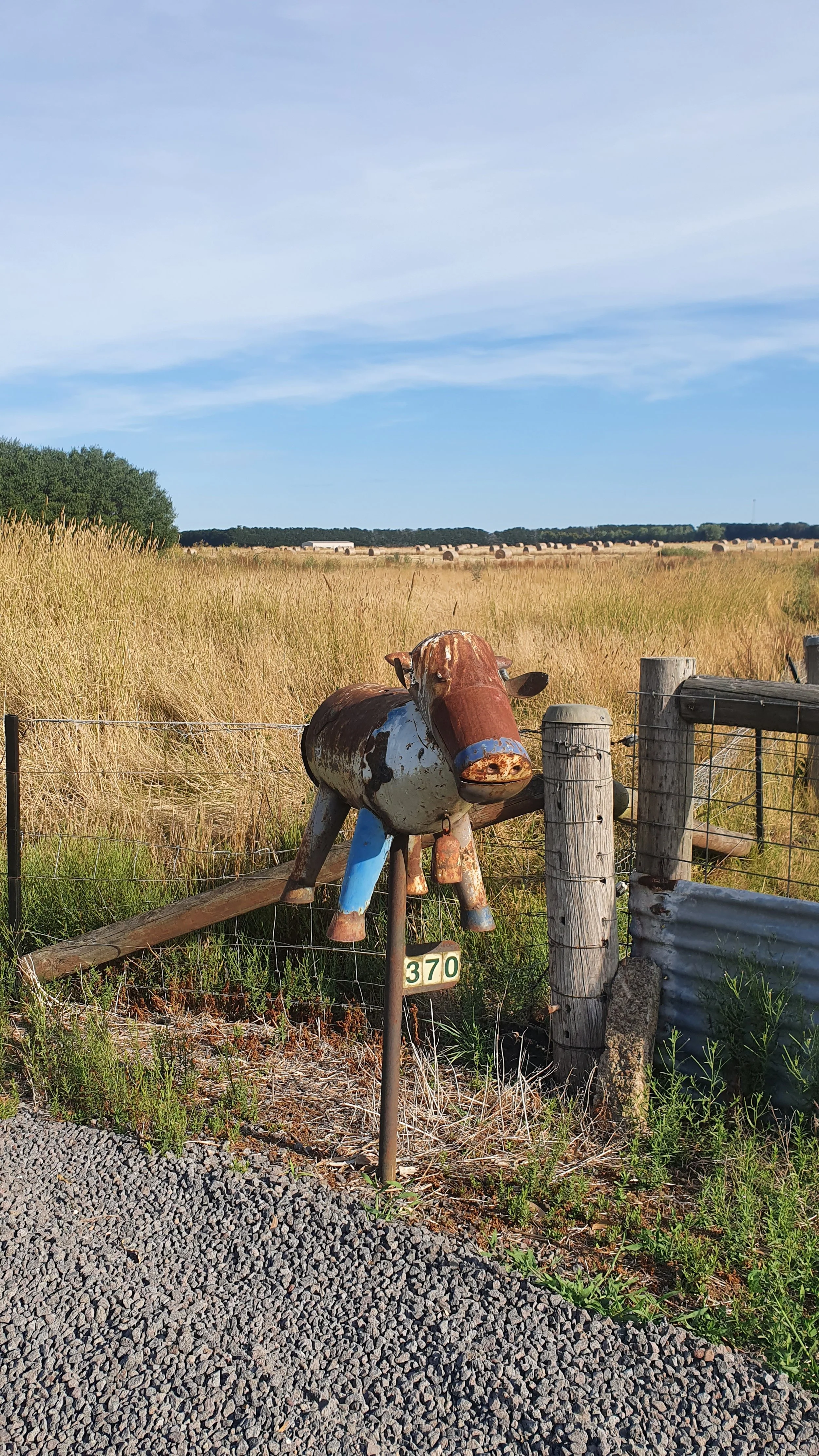
Sunday 16th January 2022. 1830hrs I am 10km out of Camperdown, where I will enjoy a cold piece of watermelon and iced coffee as my 'dinner'. I rode past this letterbox, paused for a moment, then turned around and returned to take a photo.
Throughout the trip, I saw many brilliant letter boxes (and later Christmas displays). On the WhatsApp group, I often posted my 'letterbox' of the day. The choices were often quite hard. Microwaves proved to be popular in outback NSW.

Sunday 16th January 2022. 1700hrs looking west over Lake Gnarpurt with a sense of optimism about progress; I'll ride another three hours and end up feeling satisfied with progress for the first day.
In the distance, I think I can see the Grampians National Park, which I'll ride through tomorrow afternoon. As I type this up many months after the trip, when I look at the map, I still somehow seem surprised by the progress I made and that today didn't feel 'hard' once I was able to start to control the bike.

Daily: 164.65km | 7:21:55 | 1,015m
Total: 323.99km | 14:27:17 | 1,875m
Day 02 Mortlake to Halls Gap
Monday 17th January 2022. 1630hrs at the southern end of the Grampians National Park on Grampaigns Road (Day 02 - Strava link). I had stopped in at the office to ask about Mount Zero Road to be told it should be fine. It's not. It's fucking awful. Later today, I'll deal with the corrugations, tomorrow I will be pushing my bike through soft sand.
I decided not to ride over Mount Victory Road, thinking I'd avoid the climbs; the views I am sure would have been stunning. The road from Dunkeld to Halls Gaps is brilliant. 63km, which takes you past possibly the most scenic suburban cricket ground (feels a bit like Wellington) before riding past Lake Bellfield (which has a bus stop!). Two daily services from Halls Gap to Southern Cross Station (all stops). The trip is a bit over four hours. Only one of these goes via Lake Bellfield. Not a bus you want to be late for. I wonder how many people catch this service each year from this stop?
Interestingly, Google Street View, taken in February 2010, does not show the bus stop at the time of writing (2022).
One of the downsides of bringing a lot of stuff is the time required to pack it all up. My photos show I was up before 0630hrs but didn't leave until after 0900hrs. During the course of the trip I don't think I ever really got much faster. Part of this was that, for all my bags, I simply didn't have a good way to only take one (or two) off for the evening. I would often end up unpacking and repacking the entire bike, each day. I spent the entire trip thinking I was a bag short, but I am sure I would have just filled it with more stuff. I think I had some good packing ideas, possibly with poor execution.


Monday 17th January 2022. 0630hrs I'm getting up from someone's front yard a few kilometres from Mortlake as I start Day 02 (Strava link). I see it as completely normal that I would arrive unannounced, camp in their yard and then head off the next morning. People wondered whether I was actually leaving because I was so slow to pack up. It's not like I sat around and did nothing, it just takes me hours to repack the bike, strap everything down and get moving.
Whilst I hope to never mow grass again in my life, I'm grateful other people choose to invest the time and effort to maintain a lawn. They're delightful to camp on.
I didn't start my ride until 0904hrs, which suggests I needed the best part of three hours to pack up.
One of the ideas I had been thinking about was breakfast. I believe you need to eat more calories than you think, and it is easier to do this earlier in the day, not later. Many people 'don't feel hungry when they first get up'. I understand this, and if you spend your life sitting at a desk, there are worse choices than skipping breakfast. I would argue you're better off having a serving of protein however you wish to do this and keep the calories low if that matters to you (it probably should). On long hard days, there is no better time of the day to eat a lot of calories than in the morning, as you have time and no gastrointestinal distress to deal with.
After much searching and trialling, I settled on Goldenvale Paleo Granola which is available from Aldi. Since the trip, Coles has released a similar product (called Grain Free Granola with a similar list of ingredients). I have been making a 'nut granola' for several years. At least since 2018, probably earlier. 2018 was also the year I have photos of PowerBars. We all make mistakes. My nut granola is a mix of the most common nuts and seeds (about 10 from memory) with some coconut and honey that I'd bake in the oven. I'd use this as a 'topper' on yoghurt. The process was quite time-consuming (each nut needed to be put in the food processor separately otherwise, the cashews would be in powder whilst the almonds were still being chopped) and expensive. Everyone that ever tried this thought it was amazing and suggested I should start a business. I did a quick calculation and worked out that the raw ingredients would be at least $20/kg for small batches, any major stockist would want a 100% markup. No one was buying my nut granola for $40/kg or $15 for a 300g bag. Even if they did. I still lost money as I hadn't paid for packaging, manufacturing costs etc. Side note: occasionally I’ll find a product similar to what I made at the $15 for 300g price point, they do not last long. Either they’re so wildly popular they sell out and can’t meet demand, or, as I assume, they’re too expensive for people.
Finding the Paleo Granola solves a problem I never thought anyone would. Aldi cut some corners to keep the price low, they use more seeds (~50% of the total) and fewer nuts as they're cheaper. The Paleo Granola packet is 300g and about 1,650 calories (567 calories per 100g). I had initially planned to eat half a packet with a protein powder slurry for breakfast. The slurry tastes as good as it sounds. Not great. I'd eat 1,000 calories for breakfast with a good serving of protein and fat with some carbohydrates. My planned breakfast would have had the following macros ~ 60g protein, 70g fat and 23g carbohydrates. I made two changes very quickly: I started eating most, if not the entire 300g packet each morning, and I stopped making the protein powder slurry. The reason for the change was simple, even after eating half a packet, I was still hungry. I was happy to eat the paleo granola dry and drink my black coffee to wash this down. In future iterations, I'd pack more milk powder. My revised breakfast was closer to 55g protein, 135g fat and 45g carbohydrates for a total of 1,650 calories. If you plan to eat 5000-6000 calories daily, this breakfast covers 25-30% of those calories for $7 (as of 2022). The granola doesn’t go off, doesn’t get damaged, and if you wanted, you could use the packet as your bowl.


My 'nut granola' circa 2018, when my phone camera was particularly bad. I don't think I ever took a good photo with my ZTE Axiom. This baking tray would need to be removed and turned multiple times to cook (but not burn) the granola. I leant this the hard way more than once. This tray would fill a 1.8L container. All up a good few hours of work. Around this time, I developed a spreadsheet to track calories and macros of various foods, this was quite a bit of work. Realising a small serving (a tablespoon) was about 50 calories was a revelation.
<Redacted> said, 'Australian's eat fairly well but have no concept of serving size'. I would update this statement to be true for 'well-off' Australians. Part of the spreadsheet project was to work out the serving size of any food to 100 calories. I remember working out that 100 calories of almonds is about 12 and checking my calculations multiple times, thinking this must be wrong. I wasn't. I still find this surprising.
I compare all the time, effort and money I put into my nut granola versus the paleo granola. How good is it? Good enough I'll never make another tray of what I used to.
At Mortlake, I picked up food for lunch and headed for Dunkeld via minor roads that, from memory, were quiet and in good condition. This is the story of Victoria in a sentence. Riding past the Woodhouse-Nareeb Recreation Reserve, I noticed the sign 'War Memorial Plantation September 17th 1954'. I find endless fascination in signs and monuments, particularly those from mid last century. The country is full of memorials for World War I & II, but I can't remember the last time I saw a sign for a more recent war we've sent troops to.
One of the plaques had the following text:
"Amongst the ANZACs taking part in the battle of Lone Pine on Gallipoli in August 1915, was Lance Corporal Benjamin Smith and his brother, who was killed during the ridge's capture.
Lance Corporal Smith found a cone on one of the branches of a pine tree used by the Turks as overhead cover.
He sent the cone home to his mother who kept it in a cupboard for 13 years. She then successfully germinated two seeds and raised the seedlings. One was planted in her home-town, Inverell.
In honour of her own, and other's sons killed at Lone Pine, HRH Prince Henry, Duke of Gloucester, planted the other seedling in the Australian War Memorial grounds, Canberra, October 1934.
This tree is a descendant of the seedling planted at Canberra."
I couldn't find any reference to this plantation or story for all the information available on the internet. I happened to not only pick the road to be on but, by dumb luck, turn off at the exact corner to see the signs. I had the time to stop, look and read about this place. Couple this with the foresight to take some photos and finally post this online. I'll probably never be back here, and chances are I could direct you to the general area, but without specific instructions, you’re unlikely to ever see this yourself.
Moments like this are special, not because of what I found specifically, but because they remind me why I should keep looking.

Monday 17th January 2022. 1230hrs halfway between Mortlake and Dunkeld at the corner of Hamilton-Chatsworth Road and Bundoran Lane. Having just passed through Nareeb, it looks like it might be a town, but it is only an intersection.
Looking at Google Maps I had many possible routes between Mortlake and Dunkeld, the chances I'd turn onto Bundoran Lane are low. As I noted in the report from day 02:
"Moments like this are special, not because of what I found specifically, but because they remind me why I should keep looking."
The Grampians really stand out as most of western Victoria is flat, lingering on the horizon for hours as you slowly approach them. I could see them over 100km away on the first day when I past Lake Gnarpurt, not that I knew it at the time.
I think the entire area east is fantastic and underappreciated for riding bikes. You could easily draw an approximate rectangle around Ballarat --- Hamilton --- Horsham --- Bendigo and never be much more than 100km away from a major centre. The area covered between these four towns is over 17,000 square kilometres, all of which is easily rideable on a road bike.

Monday 17th January 2022. 1330hrs I'm 13km out from Dunkeld on Bundoran Lane. Street View from 2008.
Dunkeld may be famous for many reasons, but I think special mention should go to the (only) bakery, open Thursday to Sunday 0830-1400hrs - a total of 22 hours a week. I have many questions about how small businesses make a profit or even a living in country towns. I can't imagine how this is possible with such short opening hours and being closed three days each week. If you want bread at the start of the week, drive to Hamilton.
I arrived in Dunkeld around 1400hrs, looked at the very impressive World War I display, and sampled "Australia's best tasting tap water 2018". Hard to offer an opinion on the 2022 vintage, having not tasted the 2018 vintage. This award (Australia's best tasting tap water) is judged by the Water Industry Operators Association of Australia (WIOA). There's a website detailing all the winners since 2015.
After a long lunch break in the shade of a local park, with award-winning tap water, I headed north on the main route to Halls Gap. I had asked the information office about Mount Zero Road. The person in the office hadn't been up there and couldn't offer much beyond 'it's not closed'. Based on no useful information, I headed north.
The 63km from Dunkeld to Halls Gap is great riding. The road was quiet, the scenery captivating, and there were places to stop with picnic benches and camping. Lake Bellfield is beautiful and unexpected when you first see the lake. When I planned my route, I almost skipped the Grampians as Komoot had routed me up over Mount William. This is an obscenely stupid idea only possible in the reality of software. There's no road on the east of Mount Wilson. From what I can tell, it's a tough, steep walking route that would have been (almost) impossible with a 40kg bike. Trail Hiking suggests you'd need a couple of hours to hike the 8km to a height of 1,157m. I am pretty sure their estimate does not consider carrying a 40kg bike 1,000m vertically. Thanks for the unhelpful suggestion Komoot.
With more time and effort, I think there are more interesting routes through The Grampians. I would suggest staying on the western side of the range, probably taking Victoria Valley Road and going via Red Hill Road to here. I would assume you would not find water on the western side unless you crossed a stream. Taking the direct route to Halls Gap leaves you with a choice of either climbing 500m over Mount Victory Road or heading north on Mount Zero Road. There is also the option of heading northeast on Grampians Road. In the words of Robert Frost, I choose Mount Zero Road, which is less travelled.


Monday 17th January 2022. The scenery along Mount Victory Road and Grampians Road heading north in the afternoon (L-R).
1545hrs The Grampians Cricket Club oval - one of the most picturesque cricket grounds in Australia.
1700hrs Wannon Crossing Campground - one of several campgrounds on the route. I think I saw one person in the campgrounds when I was heading up in the afternoon.
1800hrs Crossing the Great Dividing Range (424m) - this image indicates what you'll be looking at for a few hours as you ride north.
1830hrs Lake Bellfield standing on the north edge of an accessway not open to vehicles. This is the view looking north. Victoria is a contrast to NSW in many ways. NSW locks up waterways denying access to everyone, whereas Victoria allows you to swim in the lake. No state is perfect, but NSW sets a new level of stupidity when setting rules.
At Halls Gap I picked up food and water from the small supermarket and on the way out of town I passed the Community Garden where one of (the only?) volunteers happened to be working that evening. They gave me a tour and helped pick out a range of herbs and vegetables for me to take with me for my dinner. Having spent many years of my life running voluntary organisations it was beautiful to see the work of people contribute to something like a community garden that could serve so many people. On the sporting field next to the garden the local kangaroos were making themselves at home.
I found Mount Difficult Plantation Campground was only 10km north of Halls Gaps and thought this would be a short easy ride in the evening. I quickly acquainted myself with Mount Zero Rod which I was not particularly enjoying. The road was heavily corrugated and was long overdue to be graded. The next day the road would be worse, which was hard to imagine. The Plantation Campground was a beautiful spot, I had my first shower, washed some clothes and woke up very cold, shivering in my tent that evening. The 'feels like temperature' dropped to 5C. I didn't have a sleeping bag, only a light-weight silk liner. After putting on all my warm clothes I was still cold. When I posted this to WhatsApp everyone that replied suggested I should get a sleeping bag at the next town. I knew in a few short days I'd be hot and I didn't have space. This was another one of the moments when I knew to ignore well-meaning but incorrect advice.


Monday 17th January 2022. 2030hrs Mount Difficult Plantation Campground is accessible via Mount Zero Road, or if you'd prefer a more pleasant experience, you could go via Fyans Creek Road and Pines Road from Halls Gap. There is so much light late into the evening in Victoria, and I was surprised by how soft the light is. It's beautiful and very different from what I am used to. I saw two other groups camped here this evening. Neither rode their bikes.
This is a beautiful campground, but bring something warm. In the middle of summer, the overnight temperature was down to 10C, and the 'feels like' was 5C. This was due to a decent southerly blowing most of the day (which I had not appreciated as I was riding north). I was cold, given my sleep set-up was limited to a silk liner and a Lion.

Daily: 147.90km | 7:24:28 | 575m
Total: 471.89km | 21:51:45 | 2,450m
Day 03 Halls Gap to Nhill
Tuesday 18th January 2022. 1300hrs riding west on Laharum Road near Wonwondah, 20km south of Horsham. The land is hot and dry, compare the photo with Street View from February 2010 (Day 03 - Strava link). As I head north the land is going to continue to be sparse and dry, I didn't expect this at 37 degrees south (in line with Auckland, New Zealand).
Leaving the campground later than anyone would think possible, I was back on Mount Zero Road. There's a section where the trees have grown tall on the side of the road and form a canopy to ride through. After a cool start to the day, this section was stunning, and for once, the photos do justice to the experience. I might have had a handful of cars pass me during the morning. Once I crossed Roses Gap Road, the road conditions and scenery changed. The tall trees were replaced with scrubland. The blue gravel was replaced by sand. I had to start pushing my bike through a few inches of soft sand at 3km an hour. You would have needed much bigger tyres to have any chance of getting through this section. Google Maps have Street View of almost the entirety of Mount Zero Road. If I'd bothered to look, I'd have known what I was getting myself into.


Tuesday 18th January 2022. 0945hrs tall trees form a canopy over what looks like a perfectly nice road (it's not). 1045hrs north of Roses Gap Road, the tall trees are replaced by scrubland. 1130hrs at the northernmost part of Mount Zero Road, two kilometres from the Mount Zero Picnic Area, I find myself pushing my bike through soft sand as 2WD vehicles drove past (no one stopped). I'd need to be further away from civilisation before motorists would stop and say hello.
The variety of conditions and experiences on Mount Zero Road in three photos. From tree-lined to soft sand. This road has everything you never wanted. I summarised my experience on Strava (Day 03 - Strava link) as:
Somewhere in Victoria a long time ago:
Person 1: I have a metric fuck tonne of blue gravel, what should I do with it?
Person 2: Put it on Mount Zero Road.
Person 1: I did that last week.
Person 2: It's a long road, keep going until I say otherwise.
Person 1: 😐
At Mount Zero Campground, I had something to eat and, for one of the few times on this trip, had a quick walk. Near the turn-off to the campground, a strange intersection is poorly signposted. I rode in the opposite direction to where I wanted to go, backtracked, asked someone for directions, and then became even more confused. I reached the point where you open Google Maps, work out where you want to go and then ride whilst holding your phone, watching your dot move to try and track yourself. By the time I returned to sealed roads, I'd ridden 31km in two and a half hours. From the northern end of the Grampians to Horsham was about an hour and a half. Horsham was the first and last major town I'd be in between Melbourne and Mildura. Horsham has both Aldi and Bunnings - two stores I needed to visit. Aldi for more stock of the paleo granola as I was running low, and Bunnings to buy additional straps to replace some I'd lost, and larger ones to tie down some of my bags. Horsham also has the store drift, which advertises 'surf moto guns bike ski wake' apparently, they also do bike repairs.


Tuesday 18th January 2022. My time at Horsham. (L-R)
1515hrs my shopping from Aldi. While packing my bike, I ate the rice puddings and bananas in the information centre. These go well together, even better with peanut butter. The rice, cheese, cashews and crackers would be lunch tomorrow.
1630hrs final stop in Horsham was to pick up water in May Park, named after James Millar and Samuel May, who started May & Millar Iron Foundry in 1874. James Millar contributed in various ways to Horsham as Mayor (1905-06) and through donations of an organ for the Methodist Church, Hall and uniforms for the Brass Band, and funds for the Botanical Gardens. Source: Sign in May park.
I stopped in at the information centre to ask a few questions about route options, but also because I thought this would be an ideal place to leave my bike whilst I wandered around town doing my various errands. The staff were very accommodating and allowed me to repack my bike inside, out of the way and leave after they closed as I was a bit slow. Story of the trip. I left Horsham around 1630hrs and headed west on Wimmera Highway.
Whilst the day was to continue well into the evening, this concludes part I of the trip.